Geoshot...

Accurate LIDAR Data & 3D Modeling Services
Transform Your Geospatial Data with GeoShot Technologies’ LiDAR Data Processing Services in Kuwait City
In the modern era of advanced geospatial technology, LiDAR data processing plays a pivotal role in interpreting and utilizing spatial data. The process involves assigning meaningful values to points within a point cloud, enabling the identification and classification of objects and their properties. At GeoShot Technologies, we excel in offering comprehensive LiDAR Data Processing Services that transform raw geospatial data into actionable insights for a wide range of industries.
With cutting-edge technology and a highly skilled team, we provide tailored solutions to meet the specific needs of our clients. Whether you need detailed 3D mapping, terrain modeling, or feature extraction, our expertise ensures the accurate processing and analysis of your LiDAR datasets.
Why Choose GeoShot Technologies?
At GeoShot Technologies, we are committed to delivering high-quality LiDAR data processing solutions that empower our clients. Our services stand out for several reasons:
- Precision: We use advanced tools and techniques to ensure data accuracy and reliability.
- Customization: We understand that each project is unique, so we tailor our solutions to meet your specific requirements.
- Industry Expertise: Our team has experience working across various industries, including urban planning, infrastructure management, and environmental studies.
- Cutting-Edge Tools: We employ state-of-the-art software and hardware to process LiDAR data efficiently and effectively.
Our LiDAR Data Processing Services
We offer a comprehensive suite of services designed to maximize the potential of your LiDAR datasets:

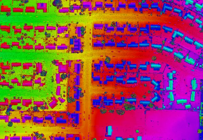
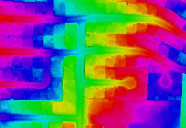
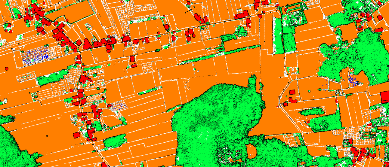
3D Point Cloud Classification
Our Point Cloud Classification services involve organizing and classifying 3D point cloud data into meaningful categories. By assigning attributes to each point, we create a foundational dataset for applications such as:
- Urban planning
- Forestry management
- Infrastructure maintenance
- Transportation systems analysis
With our expertise, we ensure the accurate and detailed classification of objects, enabling you to derive maximum value from your LiDAR data.
Get accurate and reliable point cloud classifications. Visit the 3D point cloud classification service page on our dedicated website LiDAR Data Services to learn more about our point cloud classification services including ground/non-ground, object, and advanced classification, and see our samples.
Digital Terrain Modeling (DTM)
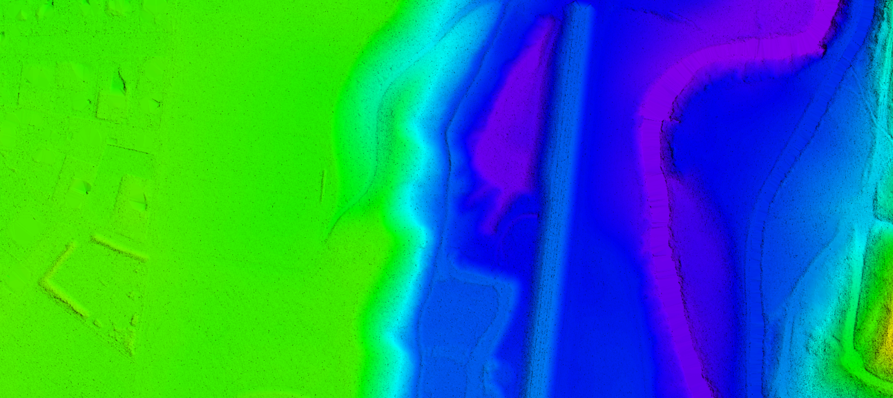
Accurate terrain data is critical for numerous engineering and environmental projects. Our DTM services generate detailed models of the Earth’s surface, capturing variations in terrain, elevation, and topographic features. Applications include:
- Flood risk assessment
- Land development planning
- Infrastructure design
By providing precise terrain models, we help clients plan and execute projects with confidence.
Uncover the hidden terrain with our precise DTMs. Explore our Digital Terrain Modeling (DTM) service and samples on the Digital Terrain Modeling service page on our dedicated website LiDAR Data Services.

Digital Elevation Models (DEM)
Our team specializes in creating Digital Elevation Models (DEMs) from LiDAR data. These models provide elevation values for specific geographic areas, making them invaluable for:
- Geological studies
- Hydrological modeling
- Disaster management
The accurate representation of elevation data ensures better decision-making in various domains.
Gain unparalleled insights with our high-resolution DEMs. Learn more about our Digital Elevation Model (DEM) service on the Digital Elevation Model service page on our dedicated website LiDAR Data Services and explore our sample data.
3D Building and Infrastructure Modeling
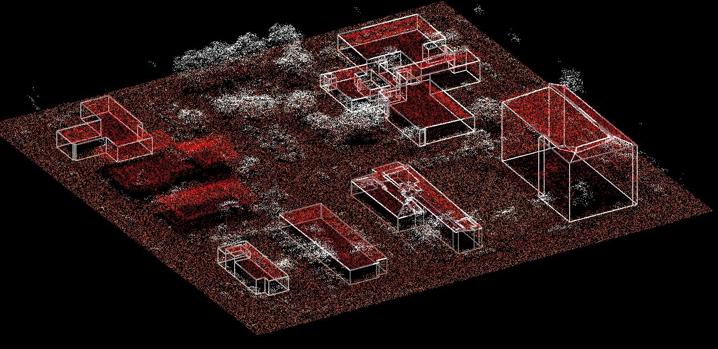
LiDAR data offers unparalleled accuracy in capturing structural details. We use 3D point cloud classification and advanced modeling techniques to create detailed 3D models of buildings and infrastructure. Applications include:
- Urban design and planning
- Architectural visualization
- Infrastructure analysis
Our models aid stakeholders in visualizing structures, assessing their condition, and planning future developments.
Transform your vision into reality with our cutting-edge 3D Building and Infrastructure Modeling service. Discover the possibilities and explore our portfolio on the 3D Building and Infrastructure Modeling service page on our dedicated website LiDAR Data Services.

Power Line Mapping
The management and maintenance of power lines are critical for ensuring uninterrupted electricity distribution. Using LiDAR data, we map power lines and assess their attributes, including:
- Vegetation encroachments
- Proximity to potential hazards
- Maintenance priorities
Our services support utility companies in maintaining safe and efficient operations.
Experience the power of accurate power line mapping. Visit our power line classification and mapping service page on our dedicated website LiDAR Data Services to explore our service and samples and see how we can improve your grid management.
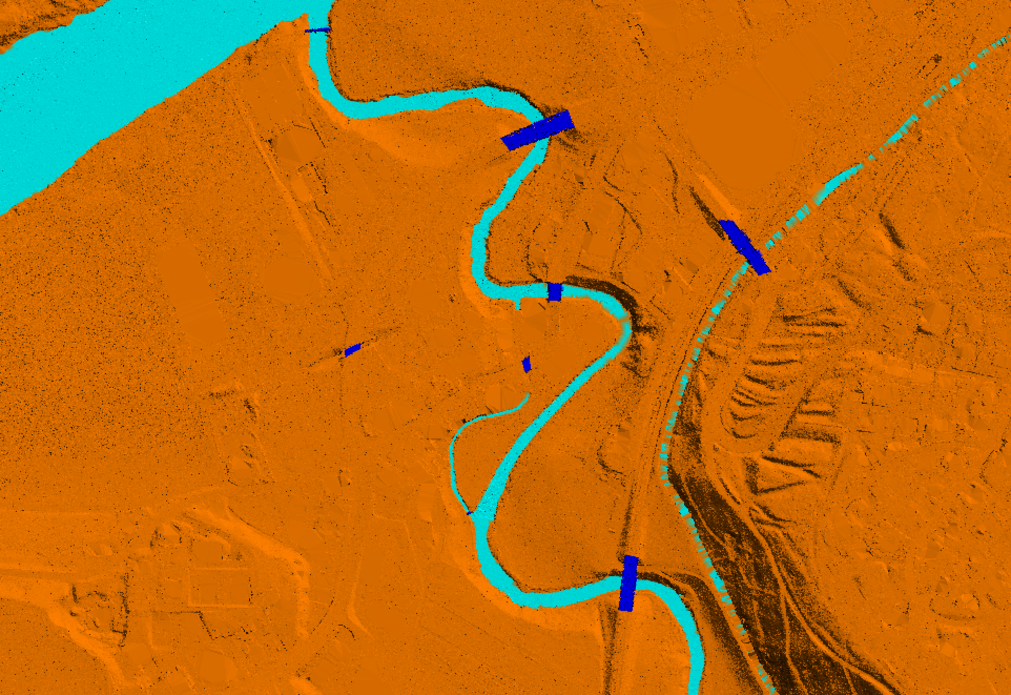
Water Classification
Water flow patterns and catchment areas are vital for hydrological studies and environmental planning. We utilize LiDAR data processing to classify water bodies and identify:
- Flow directions
- Flood-prone areas
- Catchment zones
Our expertise helps clients address water management challenges effectively.
Uncover the secrets hidden beneath the surface. Explore our water classification service on the water classification and mapping service page on our dedicated website LiDAR Data Services and see how we accurately map and analyze water bodies.
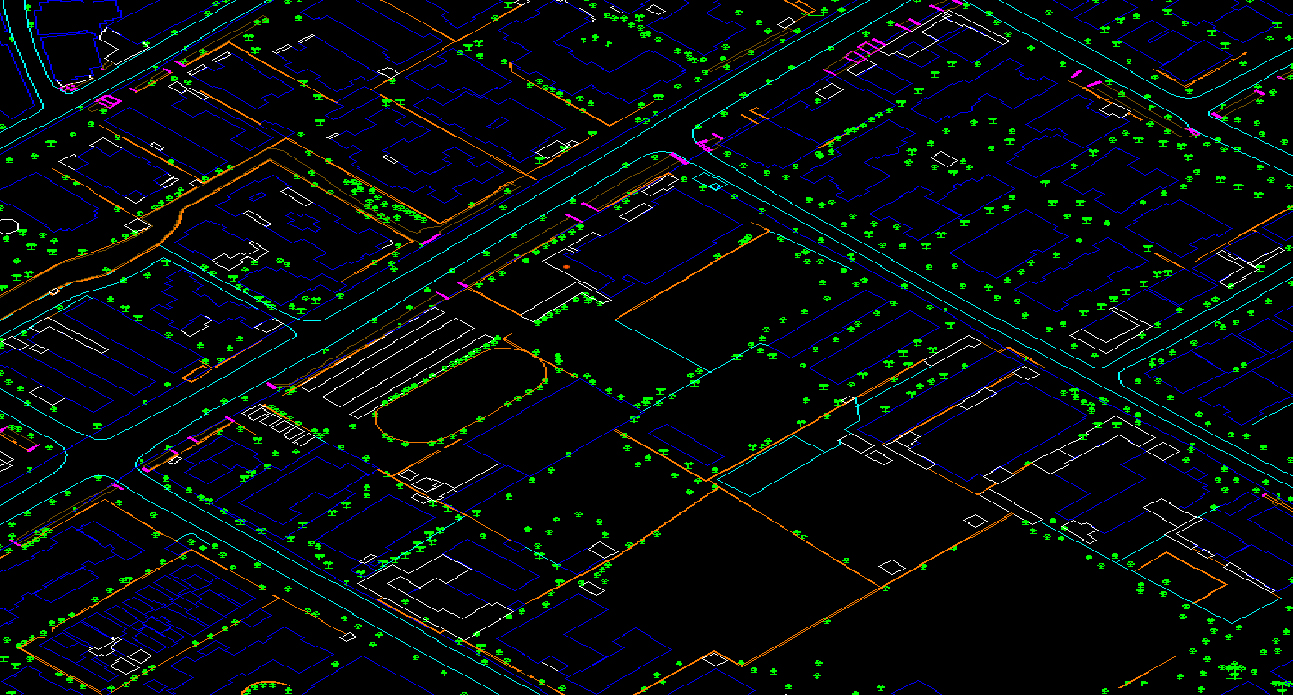
Feature Extraction
Extracting georeferenced vector features from LiDAR data is one of our core competencies. We can accurately identify and map features such as:
- Roads
- Buildings
- Vegetation
These geospatial insights support urban planning, infrastructure development, and environmental monitoring.
Transform raw data into meaningful information with our expert Feature Extraction services. Explore our feature extraction service and samples on our feature extraction service at our dedicated website LiDAR Data Services and unlock new opportunities.
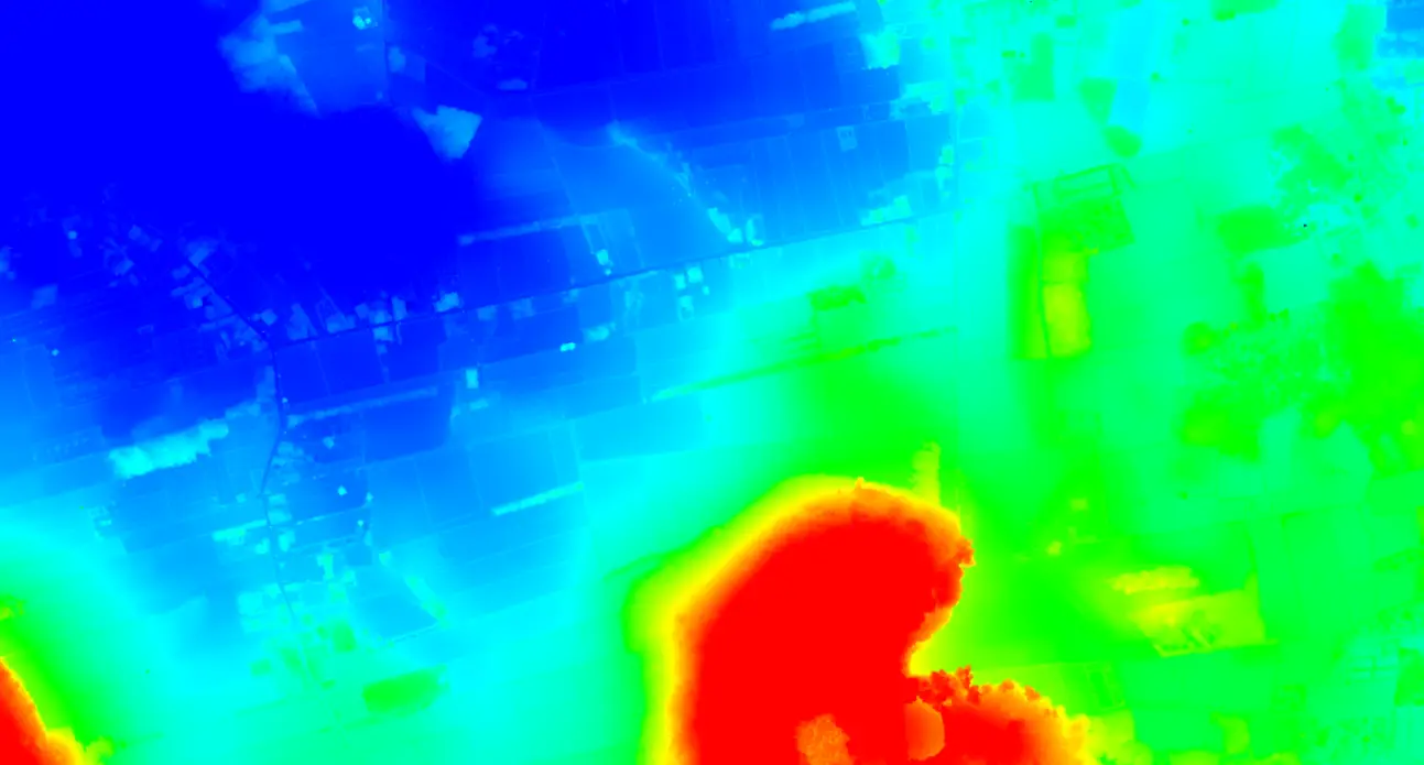
LiDAR Data Analysis and Interpretation
Processing LiDAR data is only the first step; interpreting it to extract valuable insights requires specialized expertise. Our team excels in analyzing LiDAR datasets to provide actionable intelligence for various applications, including:
- Land use planning
- Resource management
- Risk assessment
Gain a deeper understanding of the environment with our expert LiDAR data services. Visit our dedicated website LiDAR Data Services to explore our portfolio and discover how we can help you achieve your project goals.
Applications of LiDAR Data Processing
The applications of LiDAR Data Processing Services span multiple industries and use cases:
.png)
Urban Planning
Accurate 3D models and terrain data help city planners design smarter, more sustainable urban spaces.
.png)
Forestry
LiDAR enables precise tree mapping and biomass estimation, supporting forest management and conservation.

Infrastructure Management
Power line mapping and structural analysis ensure the safe and efficient operation of critical infrastructure.

Environmental Monitoring
Water classification and terrain modeling aid in understanding ecological systems and mitigating environmental risks.

Disaster Management
Digital Elevation Models and risk assessments support disaster preparedness and response strategies.

Final Delivery
The finalized GIS mapping outputs are delivered in the preferred formats, ready for immediate application.
The Geoshot Advantage
Partnering with GeoShot Technologies means gaining access to a team that is passionate about geospatial data and its transformative potential. Here’s what sets us apart:
- Expertise: Our team consists of geospatial professionals with extensive experience in LiDAR data processing and analysis.
- Quality Assurance: We prioritize accuracy and quality in every project, ensuring that our deliverables exceed client expectations.
- Timely Delivery: We understand the importance of deadlines and strive to complete projects within the agreed timeframe.
- Comprehensive Solutions: From data acquisition to interpretation, we offer end-to-end services that address all aspects of your geospatial needs.
Unlock the Potential of Your LiDAR Data
At GeoShot Technologies, we believe in the power of geospatial data to drive innovation and efficiency. Our LiDAR Data Processing Services are designed to help you transform raw datasets into meaningful insights, empowering your organization to achieve its goals.
Whether you need 3D Point Cloud Classification, terrain modeling, or feature extraction, we have the tools, expertise, and commitment to deliver exceptional results. Let us help you unlock the full potential of your LiDAR data.
Contact Us
Ready to take your LiDAR data to the next level? Contact GeoShot Technologies today at email.geoshott@gmail.com to discuss your project requirements.
Send a Message
Professional LiDAR Data Processing Services in Kuwait City
GeoShot Technologies provides professional LiDAR Data Processing Services in Kuwait City for surveyors, engineers, planners, utilities and geospatial professionals. Our team combines technical expertise, accurate project inputs and clear visual communication to create dependable deliverables for modern project requirements. Our solutions include point cloud classification, terrain modeling, feature extraction, 3D data preparation and LiDAR-derived mapping outputs. Each project is developed with attention to accuracy, usability and presentation quality so clients can confidently use the final outputs for surveying, infrastructure, urban planning, forestry, utilities and terrain analysis.
LiDAR Data Processing Services Company in Kuwait City
As a professional LiDAR Data Processing Services Company in Kuwait City, GeoShot Technologies supports surveyors, engineers, planners, utilities and geospatial professionals with reliable, project-focused solutions. We review available drawings, data, references and specifications before developing outputs that match the intended technical and presentation requirements. Our work can cover point cloud classification, terrain modeling, feature extraction, 3D data preparation and LiDAR-derived mapping outputs, helping clients improve project clarity, reduce communication gaps and present information in a structured professional format. The final deliverables are prepared according to the scale, purpose and workflow of each project and can be adapted for surveying, infrastructure, urban planning, forestry, utilities and terrain analysis.
LiDAR Data Processing Services Agency in Kuwait City
As an experienced LiDAR Data Processing Services Agency in Kuwait City, we work closely with clients to understand their project goals, source material, output standards and presentation needs. Our workflow focuses on organized production, careful detailing and consistent quality from initial inputs through final delivery. Depending on the project, our team can provide point cloud classification, terrain modeling, feature extraction, 3D data preparation and LiDAR-derived mapping outputs. This collaborative approach helps ensure that the completed work is practical, visually clear and suitable for professional use across surveying, infrastructure, urban planning, forestry, utilities and terrain analysis.
LiDAR Data Processing Services Services in Kuwait City
Our LiDAR Data Processing Services Services in Kuwait City are designed for clients who require accurate, scalable and presentation-ready project support. Services can include point cloud classification, terrain modeling, feature extraction, 3D data preparation and LiDAR-derived mapping outputs, with deliverables tailored to the available source information and desired end use. We focus on producing outputs that are easy to review, communicate and apply within real project workflows. Whether the requirement is for surveying, infrastructure, urban planning, forestry, utilities and terrain analysis, GeoShot Technologies provides flexible support aligned with the scope, format and quality expectations of each assignment.